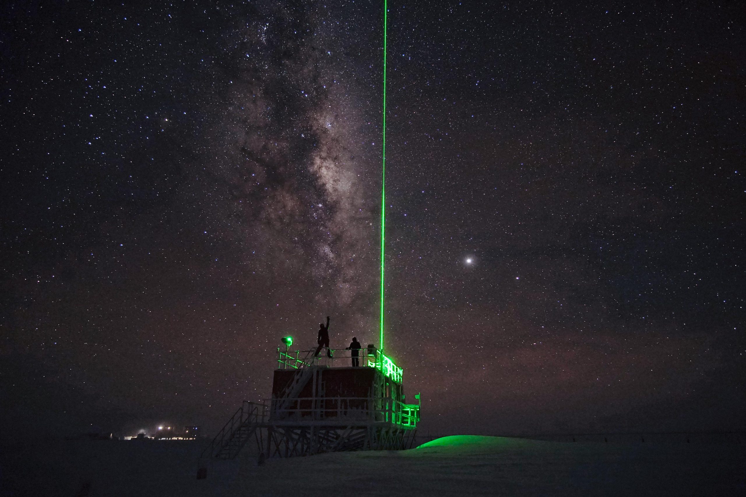
Observations of polar stratospheric clouds (PSCs) at the lidar observatory of Concordia station.
The lidar observatory at Dome C, Concordia station, is one of the primary stations of the NDACC network (Network for the Detection of Atmospheric Composition Change). Since 2014 the lidar observes polar stratospheric clouds at a height between 12 and 26 km typically, from early June until the end of Settember. These PSCs play an important role in the ozone chemistry and promote the depletion of the stratospheric ozone layer. The lidar can detect even very thin PSC layers and can provide important information about their chemical composition. The lidar can be used to study formation and dynamical processes and to provide long term records useful for climate studies.
Simple
- Date
- Unique resource identifier
- https://antarcticdatacenter.cnr.it/geonetwork/srv/api/records/149657f4-1836-11eb-8518-3d5b603fddca
Identifier
- Status
- On going
- GCMD - Instruments
-
-
LIDAR
-
- GCMD - Locations
-
-
ANTARCTICA
-
- GCMD - Platforms
-
-
GROUND-BASED OBSERVATIONS
-
- GCMD - Science Keywords
-
-
CLIMATE CHANGE IMPACT ASSESSMENT MODELS
-
ATMOSPHERE
-
POLAR STRATOSPHERIC CLOUDS/NACREOUS
-
AEROSOLS
-
CLOUD CONDENSATION NUCLEI
-
LIDAR
-
- GCMD - Providers
-
-
IT/PNRA
-
- PNRA project
-
-
OSS-12 PNRA14_00127
-
- Use limitation
- Creative-Commons CC BY-NC-SA 4.0
- Unique resource identifier
- PNRA14_00127
- Association Type
- dependency
- Initiative Type
- Project
- Association Type
- dependency
- Initiative Type
- Campaign
- Spatial representation type
- Text, table
- Denominator
- 1
- Metadata language
- English
- Character set
- UTF8
- Topic category
-
- Climatology, meteorology, atmosphere
))
- Unique resource identifier
- WGS84
- Distribution format
-
-
ASCII
(
1
)
-
ASCII
(
1
)
- OnLine resource
-
Data resource
(
WWW:LINK-1.0-http--link
)
Link to external resource
- OnLine resource
- LIDAR - PNRA Project ( WWW:LINK )
- Hierarchy level
- Dataset
Domain consistency
Conformance result
- Date (Publication)
- 2010-12-08
- Explanation
-
This data set is conformant with the INSPIRE Implementing Rules for the interoperability of spatial data sets and services
- Pass
- Yes
- Statement
-
Raw data are collected routinely by the lidar data acquisition system and successively elaborated and uploaded to the NDACC data base, usually at the end of the winter season.
- File identifier
- 149657f4-1836-11eb-8518-3d5b603fddca XML
- Metadata language
- English
- Character set
- UTF8
- Hierarchy level
- Dataset
- Date stamp
- 2025-05-12T14:20:58
- Metadata standard name
-
ISO 19115-3
- Metadata standard version
-
1.0
Overviews
Spatial extent
Provided by