RadiCA (YOPP) - Radiation fluxes and cloud features from surface-based observations in the Antarctic Peninsula and Weddell Sea Region (iso19115-3.2018)
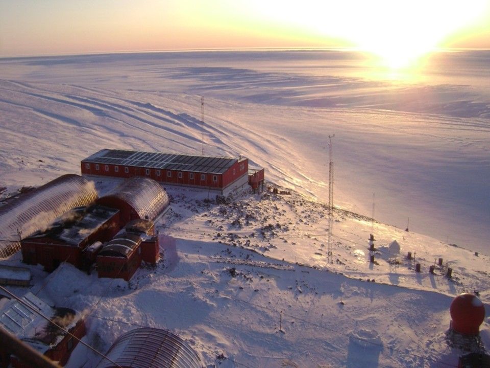
The main goal of our proposal is to characterize the surface radiative budget as well as cloudiness which features at the Argentine Bases Marambio and Belgrano II during the YOPP-SH Special Observing Period (SOP) as well as the YOPP Consolidation Phase. Specific objectives to secure our main goal during the SOP will be:
1 - develop a compact Radiation Measurement UNIT (RMU) robust enough to allow continuous measurements in harsh environment through which to make shortwave, longwave observations as well as to record status of the sky.
2 - secure UV measurements at both stations.
3 - develop specific tools to analyse on a daily basis (weakly for clouds) collected data and extract parameters of interest. For radiation these will include QA/QC SW and LW downwelling and upwelling fluxes, diffuse and direct components of solar radiation, UV spectral flux and doses. For clouds these will include, on a continuous base, cloud fraction derived both from radiometric measurement and sky camera observations, cloud type and cloud effect on SW radiation. In addition cloud base (or cloud ceiling) will be obtained by routine observations performed at the two stations. From UV measurements columnar ozone content will be also derived.
Moving forward to YOPP consolidation phase, we plan to:
1 - extend dataset and its analysis, start to collect information on seasonal and inter-annual variability, determine Cloud radiative Forcing (CRF)
2 - perform extensive comparison between automatic and visual cloudiness observation methods. They being very useful to better understand quality and value of historical datasets at the two stationsù
3 - make comparison with cloudiness regime of Ross Sea and Antarctic Plateau. Make similar comparison for UV fluxes in the Peninsula and at Concordia.
Simple
Identification info
Identifier
- Purpose
- 1 - radiation components at the surface, including global, diffuse and direct solar radiation, upwelling SW component, LW downwelling and upwelling fluxes, as well as spectral UV radiation. 2 - Cloudiness features, including, on a continuous base, cloud fraction derived both from radiometric measurement and sky camera observations, cloud type and cloud effect on SW radiation, estimate of Cloud radiative forcing (CRF), cloud base from routine observations performed at the station. 3 - From UV spectral measurements derived quantity as columnar ozone and erythemal dose. All above parameters and evaluated quantities will be carry out at the two Argentine stations of Marambio and Belgrano II
- Status
- On going
Point of contact
Principal investigator
- Spatial representation type
- Text, table
Spatial resolution
Equivalent scale
- Denominator
- 1
- Topic category
-
- Climatology, meteorology, atmosphere
- Environment
Extent
))
Temporal extent
- Time period
- 2018-09-01 2022-08-31
- Continents, countries, sea regions of the world.
-
- Weddell Sea
- Ross Sea
- Argentina
- Antarctica
- GCMD - Instruments
-
- SOLAR UV SPECTROMETERS
- Radiation Sensors
- PYRANOMETERS
- Sky View Camera
- PYRGEOMETERS
- MULTIFILTER RADIOMETER
- GCMD - Locations
-
- ROSS SEA
- ARGENTINA
- WEDDELL SEA
- ANTARCTICA
- GCMD - Providers
-
- IT/CNR/ISAC
- IT/PNRA
- GCMD - Science Keywords
-
- INCOMING SOLAR RADIATION
- ULTRAVIOLET RADIATION
- UV RADIATION
- SHORTWAVE RADIATION
- NET RADIATION
- PNRA project
-
- RadiCA PNRA18_00026
Resource constraints
- Use constraints
- License
- Other constraints
- Creative-Commons CC BY-NC-SA
Associated resource
- Language
- English
- Character encoding
- UTF8
Distribution Information
- Distribution format
-
- Text
- OnLine resource
-
Project description document
Project decription document by YOPP
Data quality info
- Hierarchy level
- Dataset
Report
Result
- Title
- COMMISSION REGULATION (EU) No 1089/2010 of 23 November 2010 implementing Directive 2007/2/EC of the European Parliament and of the Council as regards interoperability of spatial data sets and services
- Date (Publication)
- 2010-12-08
- Explanation
- This data set is conformant with the INSPIRE Implementing Rules for the interoperability of spatial data sets and services
- Pass
- true
Resource lineage
- Statement
- Data are collected continuously by radiometers and brewer spectrometers and store as minute averages with standard deviation.
- Hierarchy level
- Dataset
Reference System Information
Identifier
- Code
- WGS84
Metadata
- Metadata identifier
- urn:uuid/57f62f7d-569b-4069-bf5a-8aec56b09eb5
- Language
- English
- Character encoding
- UTF8
Point of contact
Type of resource
- Resource scope
- Dataset
- Metadata linkage
- https://antarcticdatacenter.cnr.it/srv/api/records/57f62f7d-569b-4069-bf5a-8aec56b09eb5
- Date info (Creation)
- 2020-06-25T15:34:28
- Date info (Revision)
- 2024-08-01T12:18:25
Metadata standard
- Title
- ISO 19115-3
Overviews

Spatial extent
))
Provided by
