CNR - ISAC
Type of resources
Topics
INSPIRE themes
Keywords
Contact for the resource
Provided by
Years
Formats
Representation types
Update frequencies
status
Scale
-
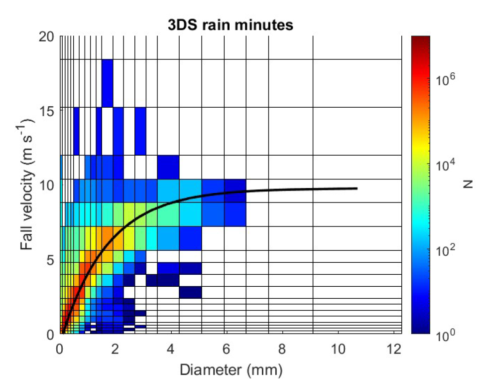
Disdrometric data from a Thies Clima 3D Stereo with 22 size classes and 20 velocity classes positioned at L'Aquila (Italy, 42.3831 N, 13.3148 E, 683 m a.s.l.), with monthly spectra and ancillary information.
-

The lidar observatory at Mcmurod, was one of the primary stations of the NDACC network (Network for the Detection of Atmospheric Composition Change) from 2004 to 2010. The lidar observes polar stratospheric clouds at a height between 12 and 26 km typically, from early June until the end of Settember. These PSCs play an important role in the ozone chemistry and promote the depletion of the stratospheric ozone layer. The lidar can detect even very thin PSC layers and can provide important information about their chemical composition. The lidar can be used to study formation and dynamical processes and to provide long term records useful for climate studies.
-
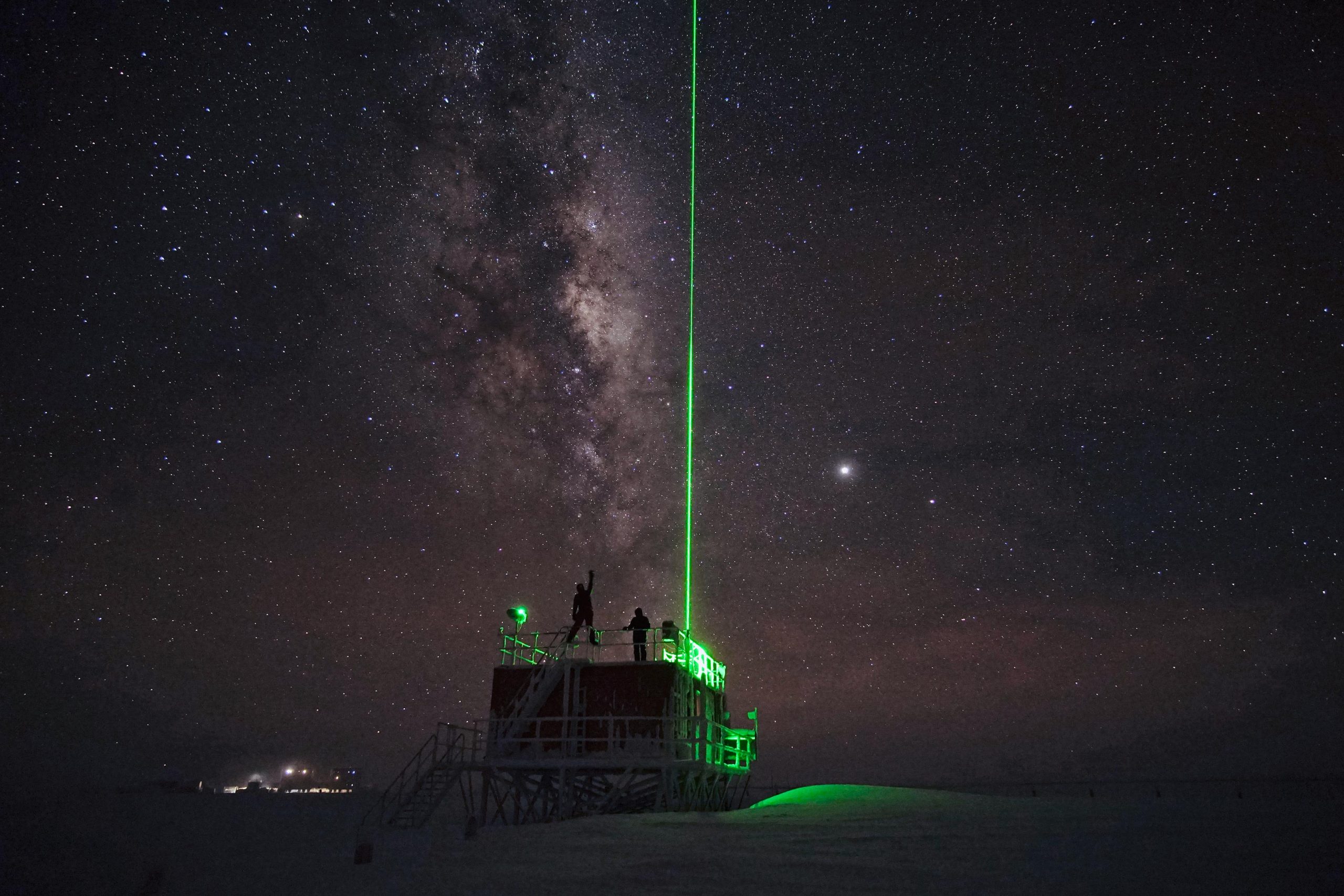
The lidar observatory at Dome C, Concordia station, is one of the primary stations of the NDACC network (Network for the Detection of Atmospheric Composition Change). Since 2014 the lidar observes polar stratospheric clouds at a height between 12 and 26 km typically, from early June until the end of Settember. These PSCs play an important role in the ozone chemistry and promote the depletion of the stratospheric ozone layer. The lidar can detect even very thin PSC layers and can provide important information about their chemical composition. The lidar can be used to study formation and dynamical processes and to provide long term records useful for climate studies.
-
Surface ozone data, collected through a UV-absorption analyzer (49i or 49c)
-
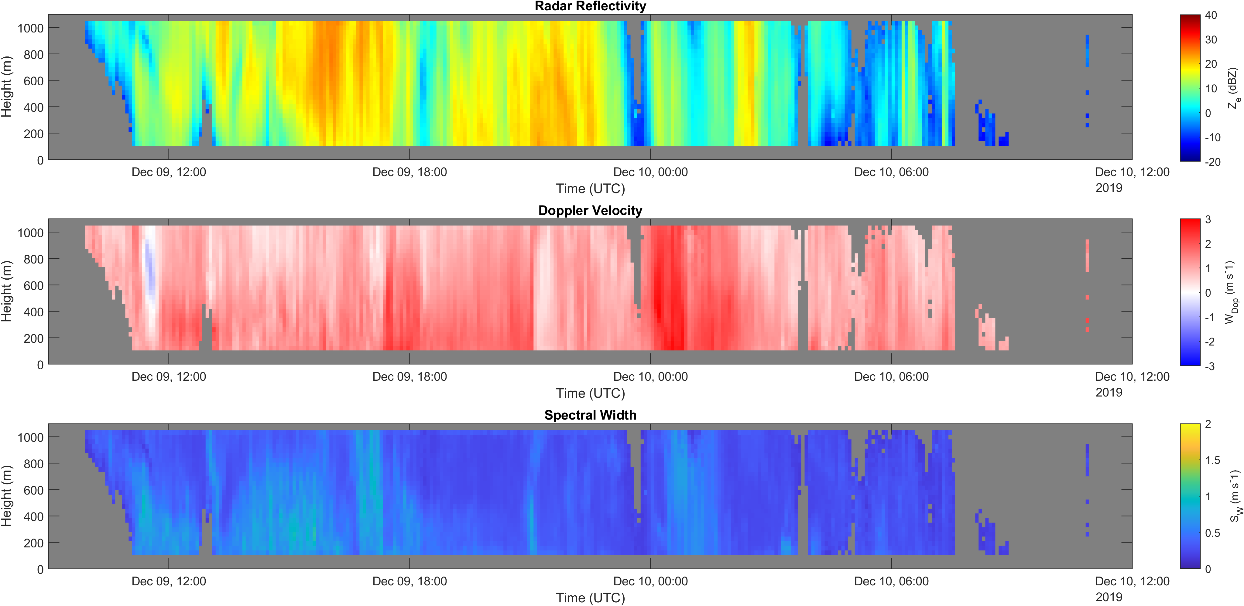
Vertical profiles along the first kilometre of atmosphere above the ground (from 105 to 1050 m a.g.l.) of equivalent radar reflectivity factor (Ze), Doppler velocity (W) and Doppler spectral width (Sw) from a 24-GHz vertically pointing Micro Rain Radar MRR-2 by METEK GmbH positioned at Mario Zucchelli Station (Antarctica).
-
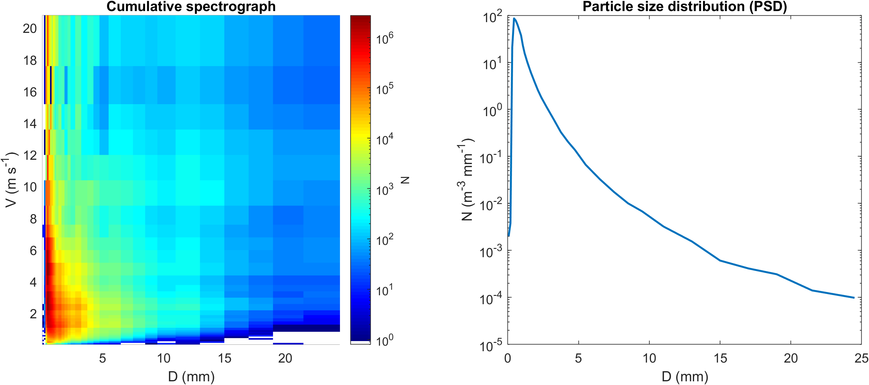
Disdrometric data from an OTT Parsivel with 32 size classes and 32 velocity classes positioned at Mario Zucchelli Station (Antarctica), with monthly spectra and particle size distributions (PSD).
-

The knowledge of properties and quantitative measurement of solid precipitation in Antarctica is of fundamental importance as precipitation represents the main input of Antarctic ice sheet mass, the variations of which have a direct and non-negligible effect on the average level of the oceans at global scale. Characterization and quantification of the precipitation is crucial in defining and validating global climate models and numerical weather prediction models, as well as anchoring and validating space-borne remote sensing estimates from missions like CloudSAT and EarthCARE. A snow and cloud microphysics observatory has been set up at the Italian Antarctic station Mario Zucchelli (MZS), integrating the pre-existing instrumentation for weather measurements. In particular, a 24-GHz vertical pointing Doppler radar, the METEK's Micro Rain Radar 2 (MRR-2), and a laser disdrometer, the OTT Parsivel, have been integrated with the advanced weather stations, radiosoundings and the ceilometer already present at MZS. The synergy between the set of instruments allows for characterizing precipitation and studying properties of Antarctic precipitation such as dimension, shape, fall behavior, particle number density, particles size distribution, particles terminal velocity, reflectivity factor and information on their vertical extent. APP started as a four-year project in July 2017, covering the Special Observation Period (SOP) in the Southern Hemisphere of Year of Polar Predicition (YOPP) period. APP can provide specific measurements for precipitation occurring over the Antarctic coast at high temporal resolution, in particular specific snow products such as snow rate, snow depth and their water equivalent. In November 2023 the observatory received an additional instrument, the Thies Clima 3D Stereo imaging disdrometer, which was previously installed for one year in Italy for testing, at the Casale Calore (AQ) meteorological observation site from the University of L'Aquila. The research team of the first two years was coordinated by Nicoletta Roberto, with operational units at the Rome unit of the CNR-ISAC (Luca Baldini, Elisa Adirosi, Stefano Dietrich) and at the Department of Physics and Astronomy of the University of Bologna (Rolando Rizzi, Federico Porcù, Tiziano Maestri, Alessandro Bracci). From 2020 the coordination of the project passed to Luca Baldini (CNR-ISAC) and the work team was extended with the research fellows Giacomo Roversi and Sabina Angeloni.
-
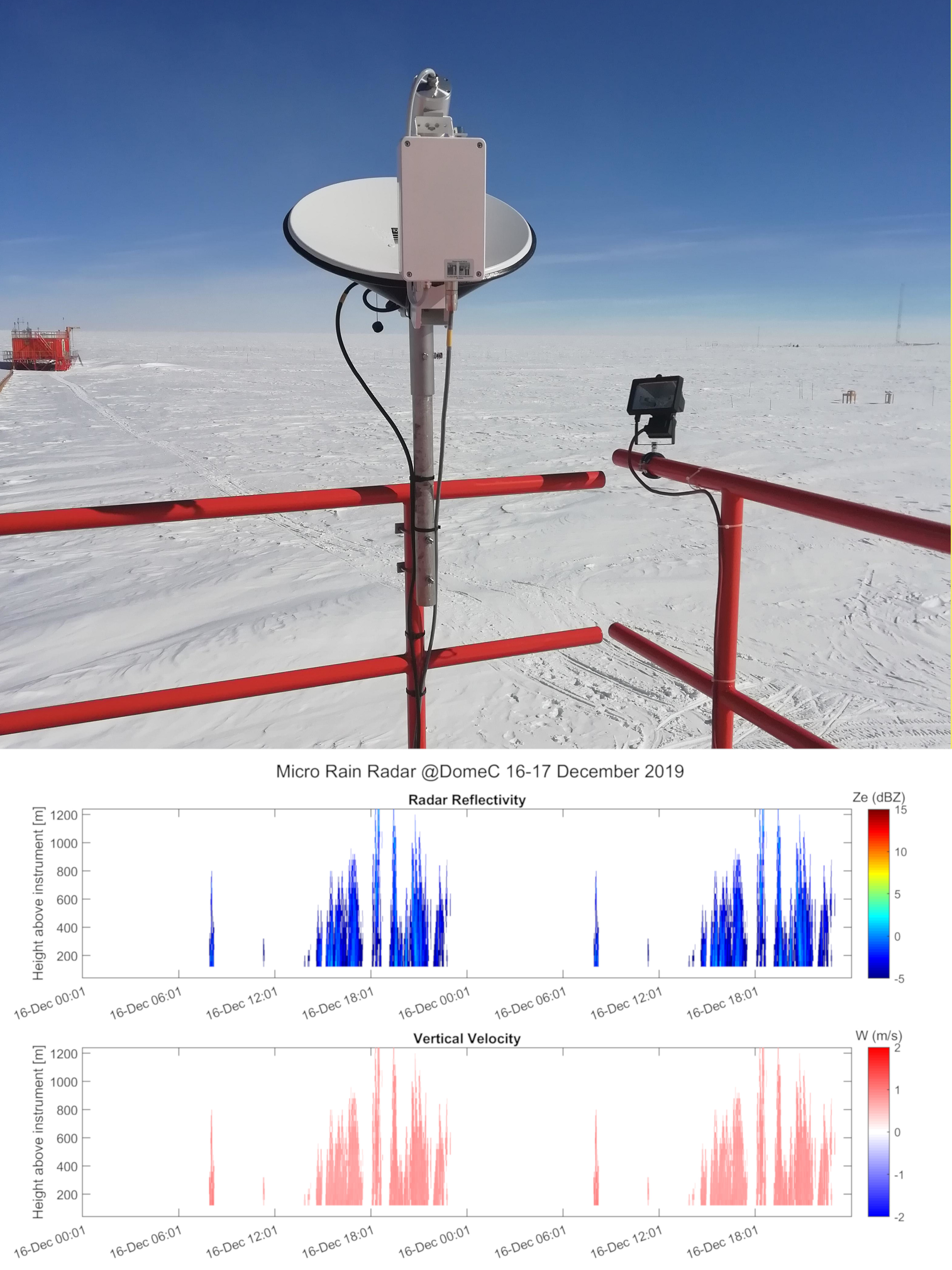
Vertical profiles along the first three kilometres of atmosphere above the ground (from 300 to 3000 m a.g.l.) of equivalent radar reflectivity factor (Ze), Doppler velocity (W) and Doppler spectral width (Sw) from a 24-GHz vertically pointing Micro Rain Radar MRR-2 by METEK GmbH positioned at Concordia Station (Dome C, Antarctica). The main objective of the FIRCLOUDS project is a complete spectral characterization of cirrus and mixed phase clouds in order to evaluate the radiative models in the FIR regime, where the clouds effect is very strong, and systematic spectral measurements are scarcely available. The micro rain radar (MRR) data allows the determination of the clouds reflectivity and the vertical velocity of ice crystals in the cases of precipitating clouds.