CNR - ISP
Type of resources
Topics
INSPIRE themes
Keywords
Contact for the resource
Provided by
Years
Formats
Representation types
Update frequencies
status
Scale
-
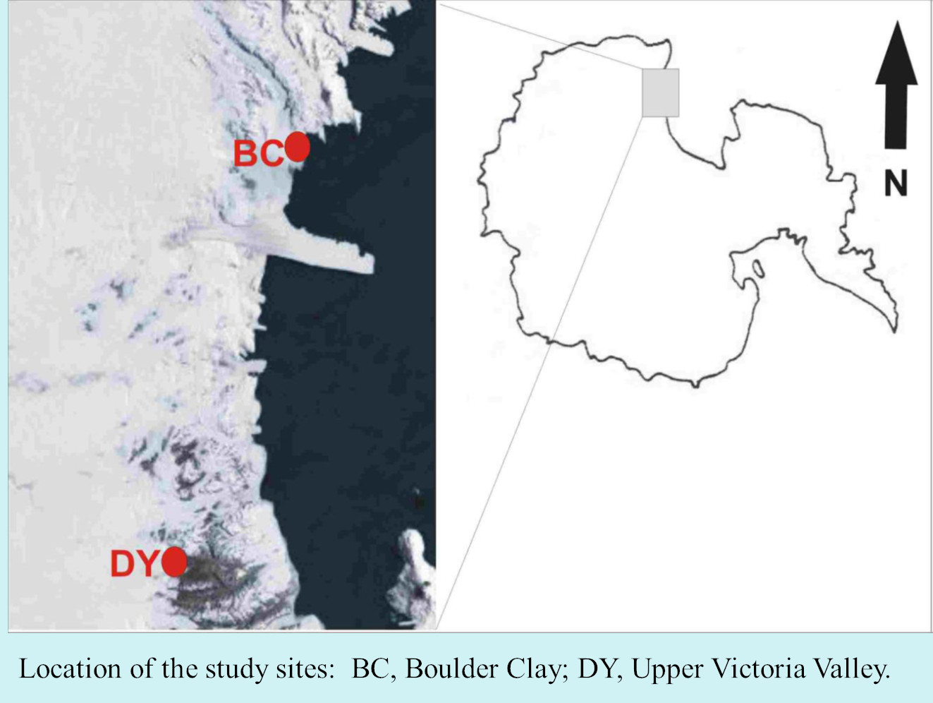
Permafrost hosts a potentially large pool of microorganisms, which is supposed to be the only life forms known to have retained viability over geological time. Thawing of the permafrost renews their physiological activity and exposes ancient life to modern ecosystems (Gilichinsky et al, 2008). The adaptation mechanisms of microorganisms, at species or population level, make them susceptible to extreme environmental conditions. The survival of microorganisms in permafrost raises the question of what constitutes the limit for microbial life (Steven et al., 2006; Wagner 2008).
-
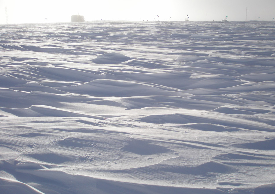
Emerging COntaminants in Antarctic Snow: sources and TRAnsport (ECO AS:TRA) Prog. PNRA18_00229 Snow samples
-
The current vision of global climatic changes stresses on the interlinked action of many factors, often more evident at regional scales. Polar regions are among the areas most sensitive to perturbations of the climate: through connections involving ocean, atmosphere, biosphere, lithosphere and cryosphere, they respond to, amplify, and drive changes elsewhere in the Earth system, so that understanding their role is essential. Peculiar characteristics of Polar Regions contribute to modify the energy and radiation budget, and the characteristics of the polar atmospheric boundary layer (ABL), increasing relevance at regional level of coupling processes between components of the climate system, especially in the coastal region. In particular, the long polar night, the sea-ice and snow coverage, favouring the persistency of stable atmospheric conditions, and the local and mesoscale circulation interactions, all affect the status and variability at different time scales of components of the regional climate system. Predicting future conditions of the polar regions is the goal of the Polar Prediction Project and of one of its key elements, the Year of Polar Prediction (YOPP, http://www.polarprediction.net/yopp.html), scheduled to take place from mid-2017 to mid-2019). This requires the scientific knowledge of their present status as well as a process-based understanding of the mechanisms of change. The parameterization of physical processes in regional and global hydrodynamical numerical models of the atmosphere is not yet enough accurate for a correct representation of all components of the climatic system and of their connections, the knowledge of which is needed to determine the role of polar regions in the global climate. As an example, more extended and integrated dataset are required to improve the parameterization of the ABL, for complex orography areas such as the polar coastal regions. The general scope of this project is to improve the understanding of the surface-atmosphere mass and energy exchanges at an Antarctic coastal site in the Ross Sea through continuous and accurate measurements of the atmospheric parameters, and development and verification of multiscale modelling, and through these activities, to address some of the relevant questions included in the roadmap for Antarctic and Southern Ocean science for the next two decades and beyond. Measurements will be carried out year-round at the new Korean Jang Bogo Antarctic Research Station (JBS), located at the coast of Terra Nova Bay, in the vicinity of the Italian Mario Zucchelli Station. Measurement and analysis of radiation components, atmospheric constituents and energy fluxes, meteorological and micrometeorological parameters, will be implemented jointly by Korea Polar Research Institute (KOPRI), CNR and UNIFI, in a way similar to the collaboration already active in the Arctic. Such implementation will be very useful to close a gap in the global climate observation system (GCOS) and contribute to WMO programs providing scientific data and information on meteorological and radiation regimes, vertical structure and chemical composition of the atmosphere.
-
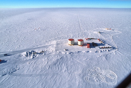
The research program aims to continue accurate measurements of surface radiative fluxes downwelling and upwelling at Dome-C, within the network Baseline Surface Radiation Network (BSRN https://bsrn.awi.de/), in order to provide broadband measurements of solar radiation short wave (in the three downwelling components direct, diffuse, global and in the global reflected fluxes) and thermal radiation (emitted from the atmosphere and from the surface). These measurements performed throughout the year provide complete information of the radiative regime in the East Antarctic Plateau, as well as its seasonal and interannual variability, and the radiative fluxes are an important input parameter for both the mass balance and regional climate models. In addition, the surface irradiance datasets are required to validate and calibrate at least 10-11 different satellite observations.
-
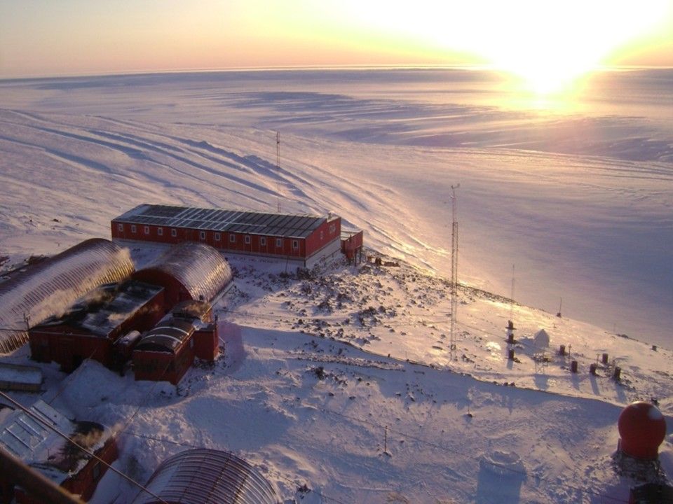
The main goal of our proposal is to characterize the surface radiative budget as well as cloudiness which features at the Argentine Bases Marambio and Belgrano II during the YOPP-SH Special Observing Period (SOP) as well as the YOPP Consolidation Phase. Specific objectives to secure our main goal during the SOP will be: 1 - develop a compact Radiation Measurement UNIT (RMU) robust enough to allow continuous measurements in harsh environment through which to make shortwave, longwave observations as well as to record status of the sky. 2 - secure UV measurements at both stations. 3 - develop specific tools to analyse on a daily basis (weakly for clouds) collected data and extract parameters of interest. For radiation these will include QA/QC SW and LW downwelling and upwelling fluxes, diffuse and direct components of solar radiation, UV spectral flux and doses. For clouds these will include, on a continuous base, cloud fraction derived both from radiometric measurement and sky camera observations, cloud type and cloud effect on SW radiation. In addition cloud base (or cloud ceiling) will be obtained by routine observations performed at the two stations. From UV measurements columnar ozone content will be also derived. Moving forward to YOPP consolidation phase, we plan to: 1 - extend dataset and its analysis, start to collect information on seasonal and inter-annual variability, determine Cloud radiative Forcing (CRF) 2 - perform extensive comparison between automatic and visual cloudiness observation methods. They being very useful to better understand quality and value of historical datasets at the two stationsù 3 - make comparison with cloudiness regime of Ross Sea and Antarctic Plateau. Make similar comparison for UV fluxes in the Peninsula and at Concordia.
-
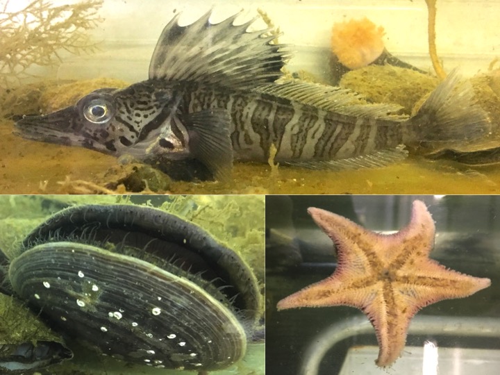
Antarctic aquatic eukaryotic biodiversity provides an unlimited and largely unexploited source of bioactive molecules that may be utilized for the benefit of human health. The aim of our proposal is to probe antibiotic and anticancer properties of these molecules isolated from a selected panel of freshwater and marine eukaryote species, that can be sampled in the area of MZS with no impact on local biodiversity and can, in large measure, be cultivated and/or maintained in laboratory for long periods at very reduced costs. The sampling of species will be conducted on Protists (ciliates and dinoflagellates), Rotifera (bdelloids), obtaining sponge primmorphs, collecting fish body surface mucus, sequencing transcriptomes from Protists, Rotifers, Echinoderms, and Tunicates to be scanned for genes expressing antimicrobial peptides and enzymesproducing bioactive metabolites. The targets of the project are: i) to sample Protists, Rotifers and macroeukaryotes from marine and freshwater environments, ii) to culture Protists, Rotifers, andobtain demosponge primmorph cultures, iii) to sequence transcriptomes to be added to transcriptomes already obtained by the proposing groupand to identify putative candidate peptides, iv) to obtain purified biochemical fractions from Protists, Rotifers, primmorph and fish surface mucus,v) to test produced fractions and synthetic peptides for their in vitro anticancer and antibiotic activities. The proposal involves three research unitsof the Universities of La Tuscia, Trieste and Camerino, and one unit of the National Research Council in Naples. These units maintain solid and documented relationships of collaboration with a multi-year experience in Antarctic eukaryotic physiology, biochemistry and molecular biology.The proposal can also rely on the official collaboration with the laboratories of Prof. Ian Hawes and Prof. Chris Battershill from the University ofWaikato (NZ), with experience in Antarctic freshwater biology and bioactive molecules.
-
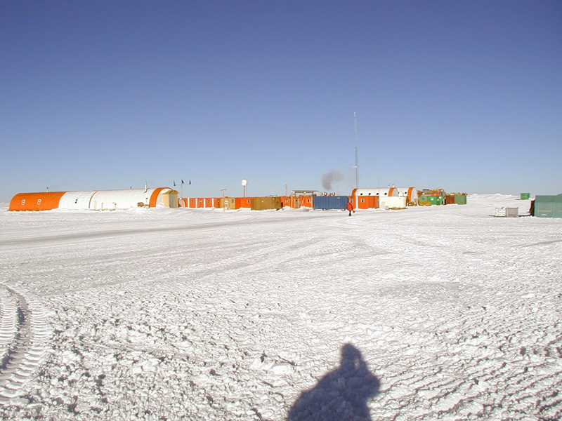
The DoCTOr (Dome C Tropospheric Observer) project aims to establish an integrated monitoring system to measure simultaneously, continuously and with a high temporal resolution the water vapor and temperature vertical profiles and the radiative exchanges vs. altitude. The monitoring will enable us to detect both long-term trends and fast-evolving phenomena, the latter useful in the interpretation of the causes of the first. This task is performed mainly through remote sensing techniques, allowing for the study of a highly unperturbed atmospheric sample. The integration of all the deployed instrumentation in a single acquisition system simplifies greatly the data analysis needed to retrieve the final products: The REFIR-PAD spectroradiometer (already operating in dome C since 2011) will provide spectrally-resolved atmospheric downwelling radiances in the mid to far-infrared spectral range, while a laser diode based profiler will characterize the microphysics state of the first 3 km of the atmosphere.A real-time data analysis system based on an atmospheric radiative transfer model will then retrieve from the acquired data the temperature and water vapor profiles and the cloud optical thickness in almost all weather conditions found at Dome C, with a temporal resolution of about 10 minutes.
-

The lidar observatory at Mcmurod, was one of the primary stations of the NDACC network (Network for the Detection of Atmospheric Composition Change) from 2004 to 2010. The lidar observes polar stratospheric clouds at a height between 12 and 26 km typically, from early June until the end of Settember. These PSCs play an important role in the ozone chemistry and promote the depletion of the stratospheric ozone layer. The lidar can detect even very thin PSC layers and can provide important information about their chemical composition. The lidar can be used to study formation and dynamical processes and to provide long term records useful for climate studies.
-
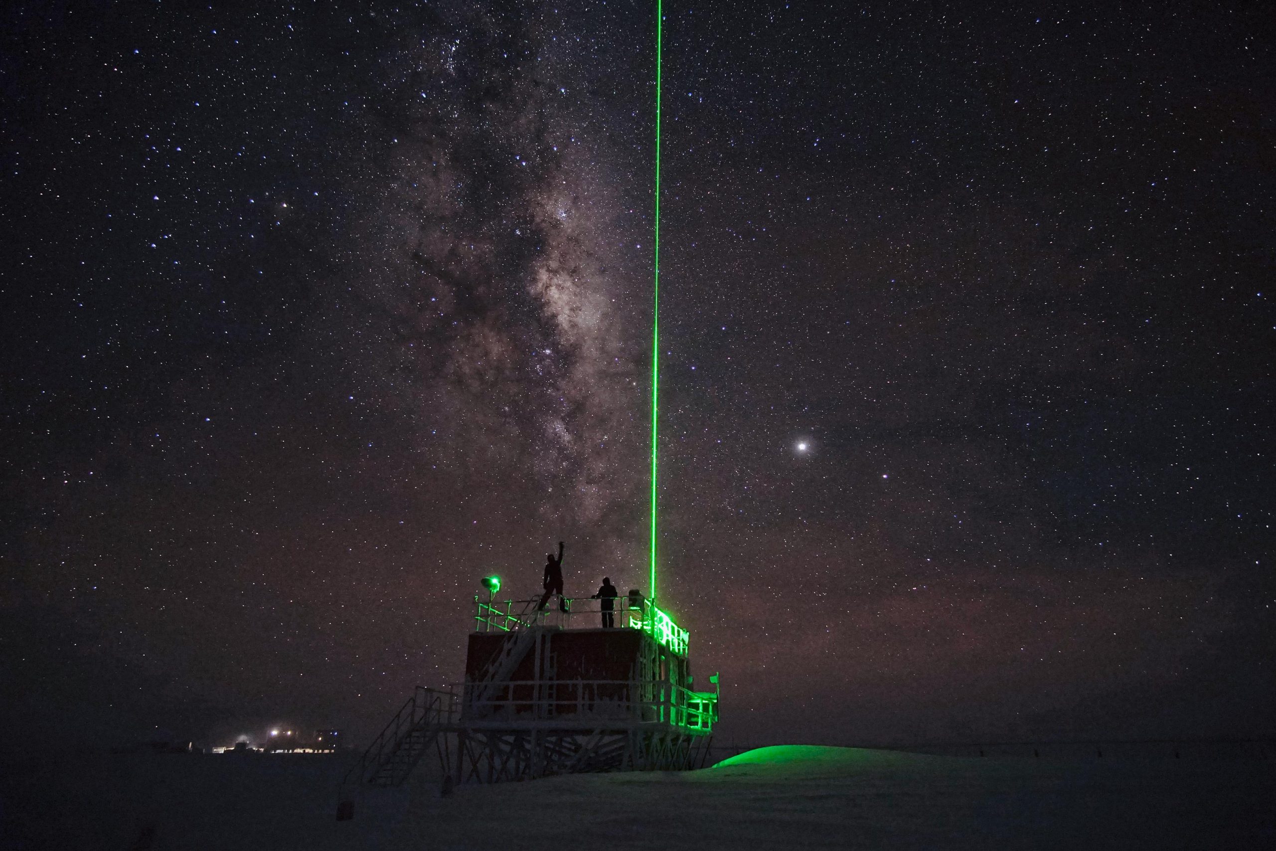
The lidar observatory at Dome C, Concordia station, is one of the primary stations of the NDACC network (Network for the Detection of Atmospheric Composition Change). Since 2014 the lidar observes polar stratospheric clouds at a height between 12 and 26 km typically, from early June until the end of Settember. These PSCs play an important role in the ozone chemistry and promote the depletion of the stratospheric ozone layer. The lidar can detect even very thin PSC layers and can provide important information about their chemical composition. The lidar can be used to study formation and dynamical processes and to provide long term records useful for climate studies.
-
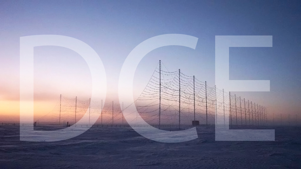
The HF radar denominated Dome C East (DCE) emits pulses of HF waves (8–20 MHz) which are refracted in the ionosphere and can be back-scattered by field aligned decameter scale irregularities of the electron density at distances ranging from 180 to 3550 km from each radar and at heights between 100 and 400 km. The radar signals are steered in 16 emission beams, separated by 3.3 degrees, in an azimuthal interval of 52 degrees, usually swept in 2 minutes. The signals are emitted according to multi-pulse sequences that allow the real-time acquisition of the autocorrelation function of the back scatter echoes, from which the reflected power, the VD Doppler velocity of the irregularities, and the spectral width can be calculated for each distance-azimuth cell. VD coincides with the velocity of the plasma along the line of sight. DCE is part of the Super Dual Auroral Radar Network (SuperDARN). In SuperDARN, pairs of radars, typically located at 2000 km distance and oriented so that their beams cross each other over the region to be studied, are used to get the velocity vector in two dimensions. DCE forms a common-volume pair with the SuperDARN South Pole radar (U.S.). SuperDARN radars are devoted to the study of ionosphere, between 100 and 400 km from ground, in the polar, auroral and medium latitude regions. The SuperDARN and DCE scientific objectives span from fundamental plasma physics to space weather in the framework of Sun-Earth relations. Italy participates in the SuperDARN international network also with the Dome C North radar(DCN), installed at the Concordia station in January 2019 and operative since then.