Concordia Station
Type of resources
Available actions
Topics
INSPIRE themes
Keywords
Contact for the resource
Provided by
Years
Formats
Representation types
Update frequencies
status
Scale
-
The ideal site for the measurement of solar and terrestrial radiation for meteorological purposes is one that has a completely flat horizon. The WMO Guide to Meteorological Instruments and Methods of Observation (WMO No. 8) recommends that if possible no obstruction should be present, particularly within the azimuth range of sunrise and sunset over the year. This dataset describes the horizon at the BSRN radiation site DOM as additional information on the site's surroundings.
-
The Concordia Research Station provides a unique location for preparatory activities for future human journey to Mars, to explore microbial diversity at subzero temperatures and monitor the dissemination of human-associated microorganisms within the pristine surrounding environment. The present study was performed in the frame of the BacFinder project (European Space Agency, ESA AO-13-Concordia) with the aim to unravel the environmental- and human-associated microbial diversity in the surrounding of the Concordia Station. This is the first intensive and extensive surface snow sampling performed monthly over a two-year period at three distances (10, 500, and 1000 m) from the Concordia Station, and investigated by a high-throughput sequencing approach. Emphasis was laid on the relation between microbial presence and both seasonality and distance from the Base. Data suggested that if present the anthropogenic impact was below the detection limit of the employed DNA sequencing-based techniques. On the other hand, our study corroborated the use of DNA sequencing for revealing microbial presence in remote and hostile environments, with implications for Planetary Protections and for life-detection in astrobiology relevant targets.
-

This dataset reports the height observations of the Italian stake farm at the Concordia Station, Antarctica. The stake farm consists of 13 stakes, separated from each other by 10 m, arranged in a cross shape structure, located approximately 800m southwest of the Station and sampled on monthly basis or so.
-
This is a compilation of all Concordia station datasets that were/are published in the frame of BSRN. The collection will be updated regularly with recent data. The data are subject to the data release guidelines of BSRN (https://bsrn.awi.de/data/conditions-of-data-release/). Basic and other measurements of radiation at Concordia station (2006-01 et seq) .
-
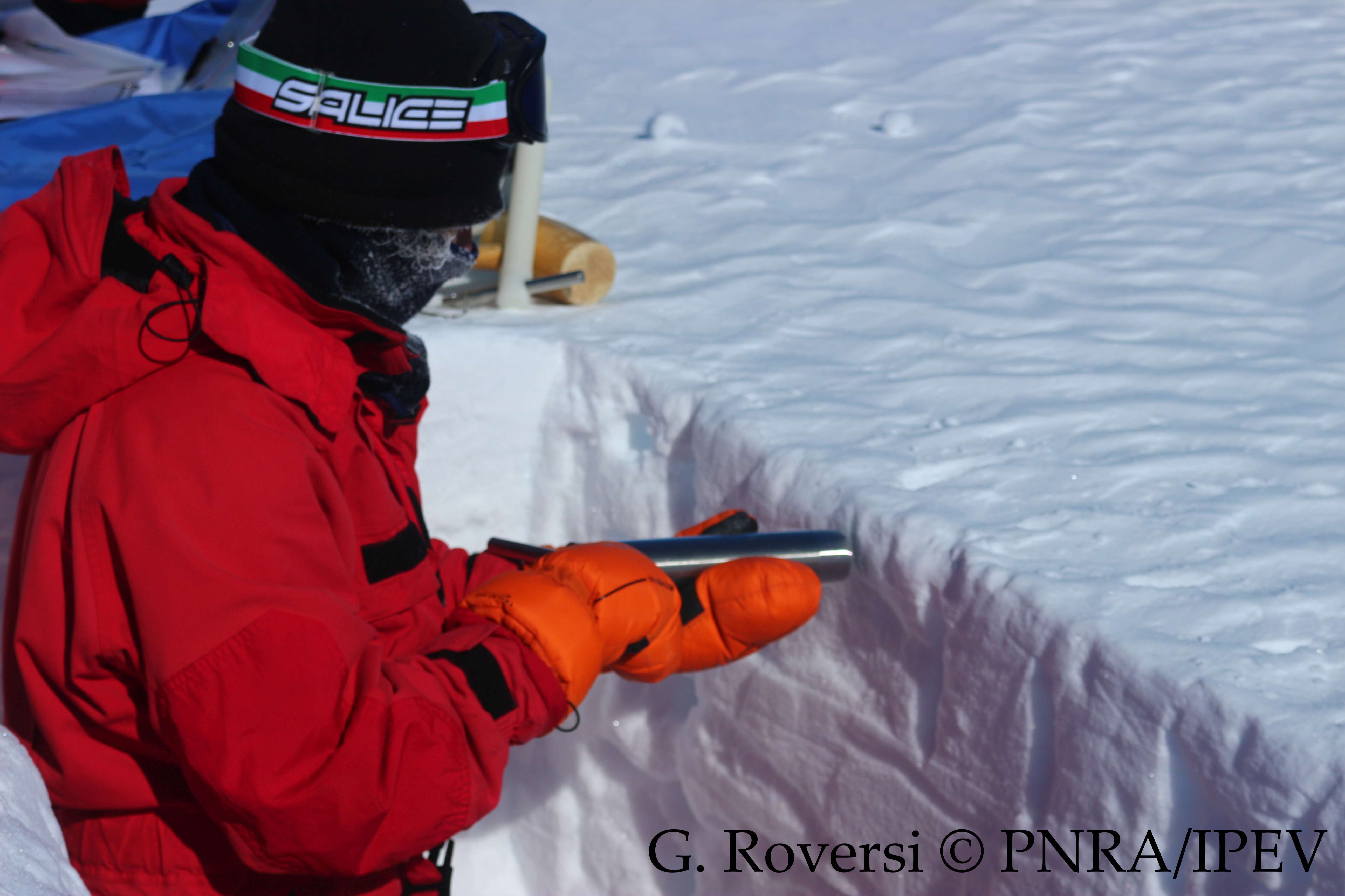
This dataset reports the snow density observations at the Concordia Station, Antarctica. A snow trench is dig once per month (or every three months during winter) in the clean area near the Station (< 1 km). Four measurements are taken inserting a core barrel (with a diameter of 4.5 cm and a length of 25 cm) horizontally into the snow at 10 cm depth, and four more measurements are taken inserting another core barrel (with a diameter of 3.7 cm and a length of 9.2 cm) vertically, from the surface to 10 cm depth. The snow density is calculated from the weight.
-
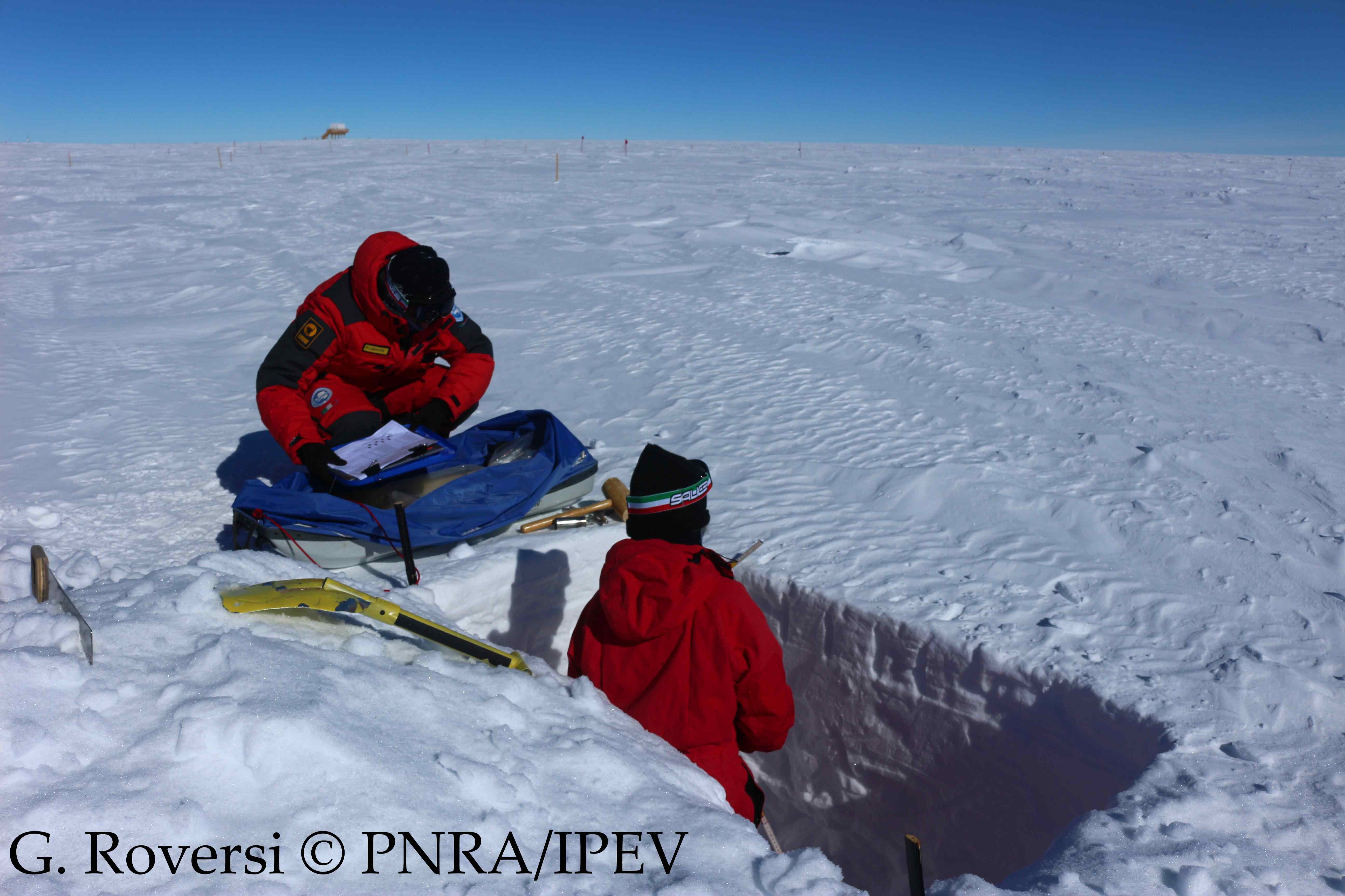
This dataset reports the snow density, temperature and hardness observations from the surface to 1 m depth at the Concordia Station, Antarctica. A snow trench is dig once per month (or every three months during winter) in the clean area near the Station (< 1 km). The snow density measurements are taken inserting a core barrel (with a diameter of 4.5 cm and a length of 25 cm) horizontally into the snow every 10 cm from 0 to 1 m depth. The snow density is calculated from the weight. For each layer the temperature and the hardness (ranging from 1 to 6) are also recorded.
-
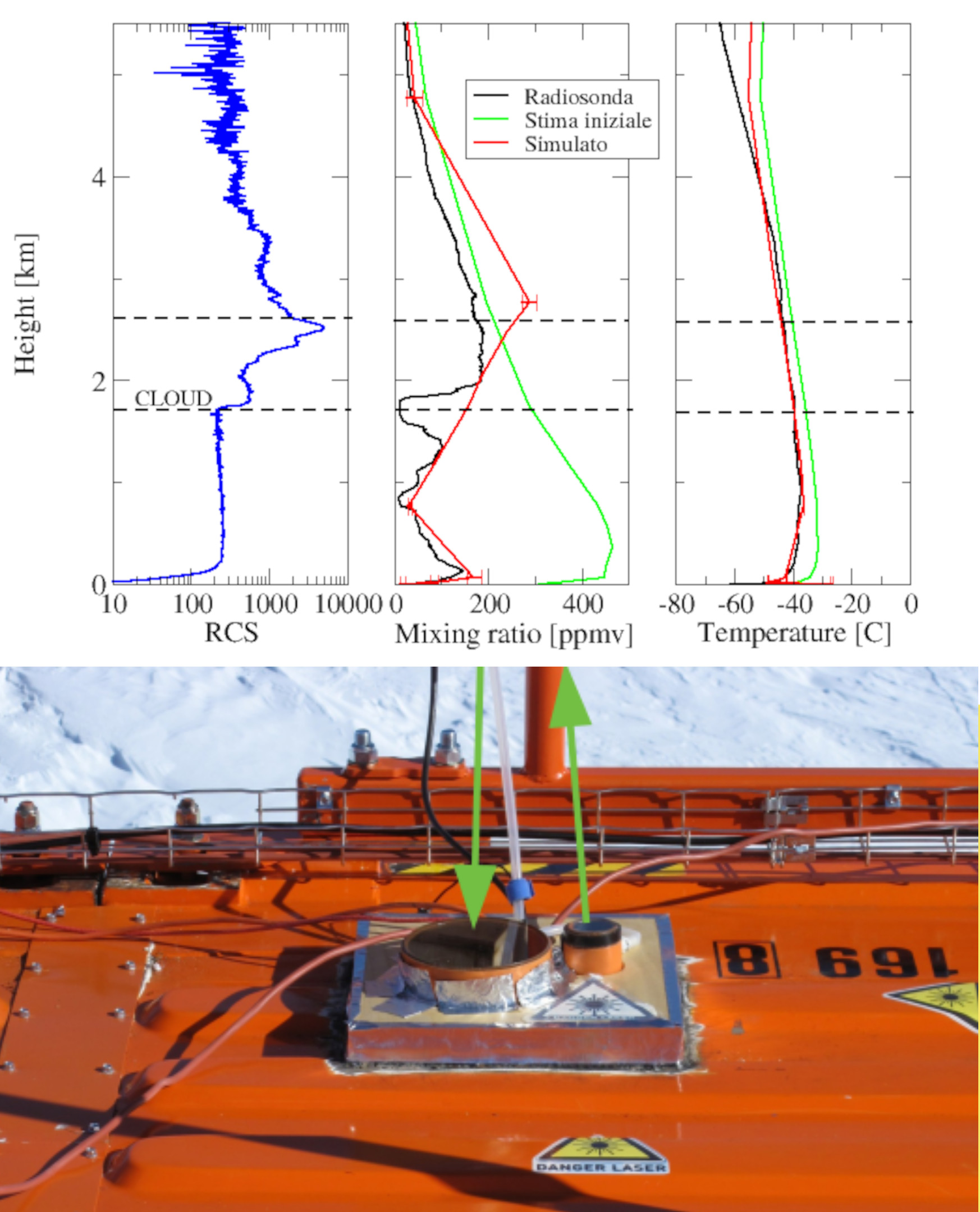
Backscattering and depolarization data from a LIDAR positioned at Concordia Station (Dome C, Antarctica). Data are available on the INO-CNR server on request to Dr. Massimo Del Guasta. The main objective of the FIRCLOUDS projectis a complete spectral characterization of cirrus and mixed phase clouds in order to evaluate the radiative models in the FIR regime, where the clouds effect is very strong, and systematic spectral measurements are scarcely available. A backscattering/depolarization lidar contributes to the estimation of the clouds position and phase, and of the optical extinction profile.
-

Pictures of the ice camera and the halo camera positioned at Concordia Station (Dome C, Antarctica). Data are available on the INO-CNR server on request to Dr. Massimo Del Guasta. The main objective of the FIRCLOUDS project is a complete spectral characterization of cirrus and mixed phase clouds in order to evaluate the radiative models in the FIR regime, where the clouds effect is very strong, and systematic spectral measurements are scarcely available. The ice and halo imager cameras enable an assessment of the cloud ice crystals micro-physics.
-
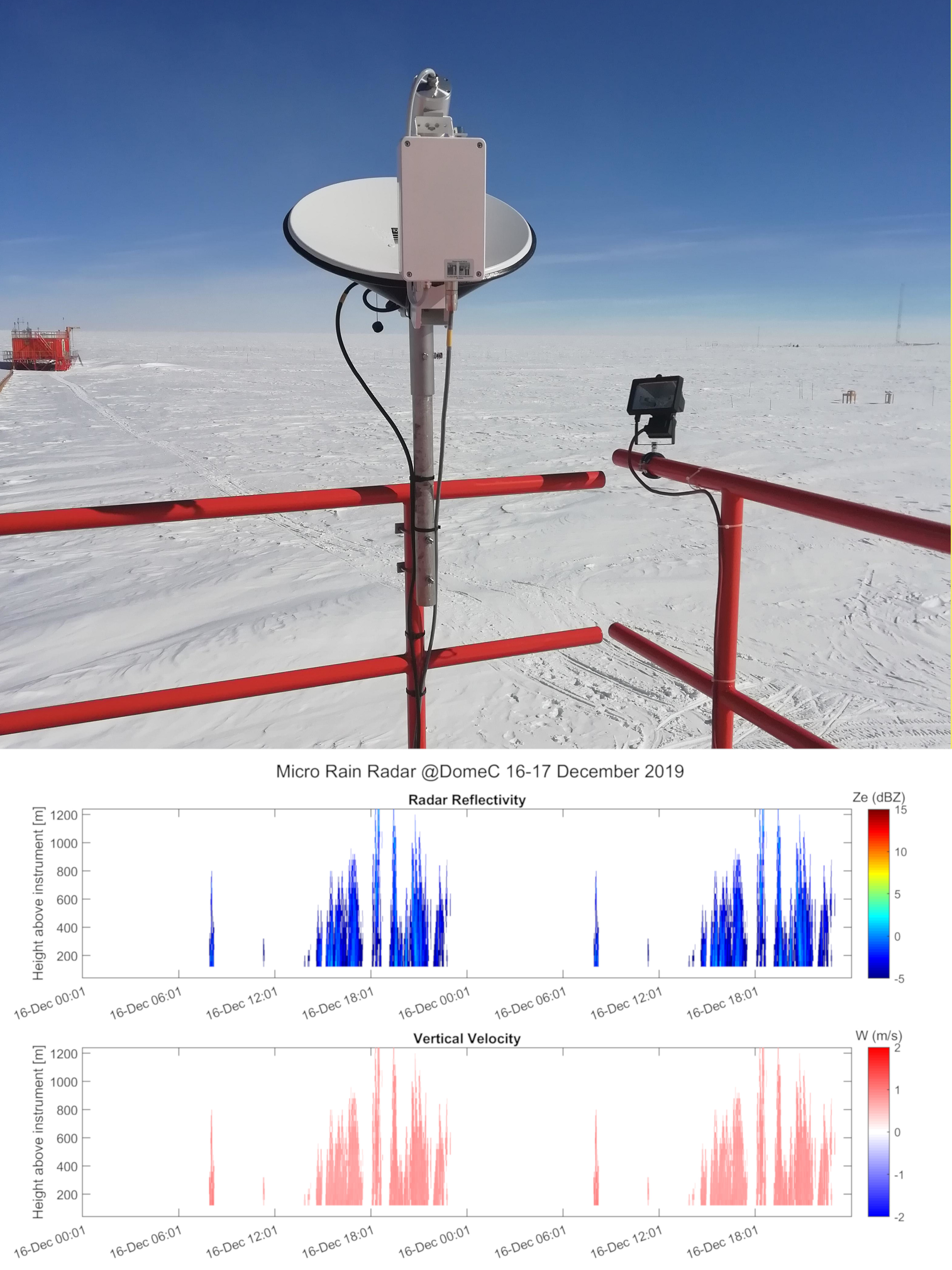
Vertical profiles along the first three kilometres of atmosphere above the ground (from 300 to 3000 m a.g.l.) of equivalent radar reflectivity factor (Ze), Doppler velocity (W) and Doppler spectral width (Sw) from a 24-GHz vertically pointing Micro Rain Radar MRR-2 by METEK GmbH positioned at Concordia Station (Dome C, Antarctica). The main objective of the FIRCLOUDS project is a complete spectral characterization of cirrus and mixed phase clouds in order to evaluate the radiative models in the FIR regime, where the clouds effect is very strong, and systematic spectral measurements are scarcely available. The micro rain radar (MRR) data allows the determination of the clouds reflectivity and the vertical velocity of ice crystals in the cases of precipitating clouds.