Ross Sea
Type of resources
Available actions
Topics
INSPIRE themes
Keywords
Contact for the resource
Provided by
Years
Formats
Representation types
Update frequencies
status
Scale
-

The datataset includes sound pressure levels acquired in the Ross Sea during project AMORS
-
The larval stages can be considered as the link from plankton to benthos. In order to study larval recruitment from zoobenthos, 40 tiles were placed at each of the four sites outlined in the project: Tethys Bay (control), Rod Bay (area subject to anthropogenic impact), Faraglione (control) and Adelie Cove (area subject to natural impact, linked to the presence of a penguin house). Due to adverse environmental factors all the tiles from Faraglione were lost and from Tethys Bay only half were found. The tiles were analysed with the help of a binocular, which enabled better visualisation of the organisms and, consequently, better identification.
-
Antarctic ecosystems have a high number of species, that are closely linked to the presence of sea ice and seasonal cycles. This biodiversity is subject to anthropogenic and natural influences. Macrozoobenthic communities are the 'biological memory' of the ecosystem, structuring themselves as a function of environmental changes over the years. Macrozoobenthos samples were collected using suction dredging and scraping techniques, in soft and hard bottoms. Sampling occurred in 5 different sites.
-

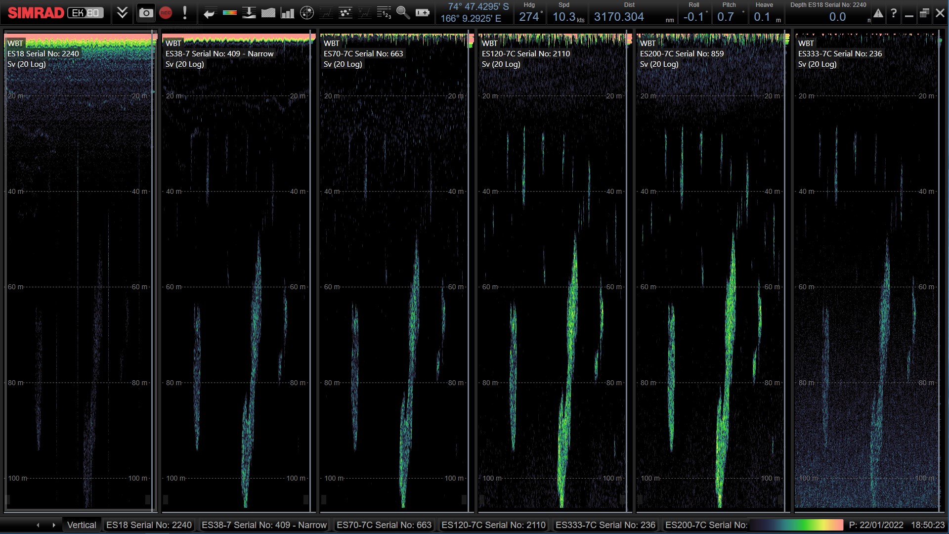
The Middle Trophic Level of the Ross Sea is still not well known but it mainly characterized by two species of Krill: Euphausia superba, Euphausia Crystallorophias. These species are a key food source for a wide variety of marine birds and mammals in the Ross Sea. For this reason, it's necessary to improve the knowledge on abundance and spatial distribution of MTL species, and their interconnection with environmental parameters to understand the main drivers of the reproductive success and migrations of these species. In this project, an acoustic survey, a synoptic net sampling and a CTD/XBT samplings were carried out following the standard protocols indicated by CCAMLR. Acoustic monitoring was performed at five frequencies: 38, 70, 120, 200 and 333 kHz. Targeted net samplings were performed to validate the preliminary species allocation of the aggregations observed on the echosounder screen. Biometric measures of krill samples was made on board and samples were taken for further analysis. CTD and XBT data was collected and elaborated to characterize water masses and to study the possible influences of the distribution of the main oceanographic parameters on MTL species.
-

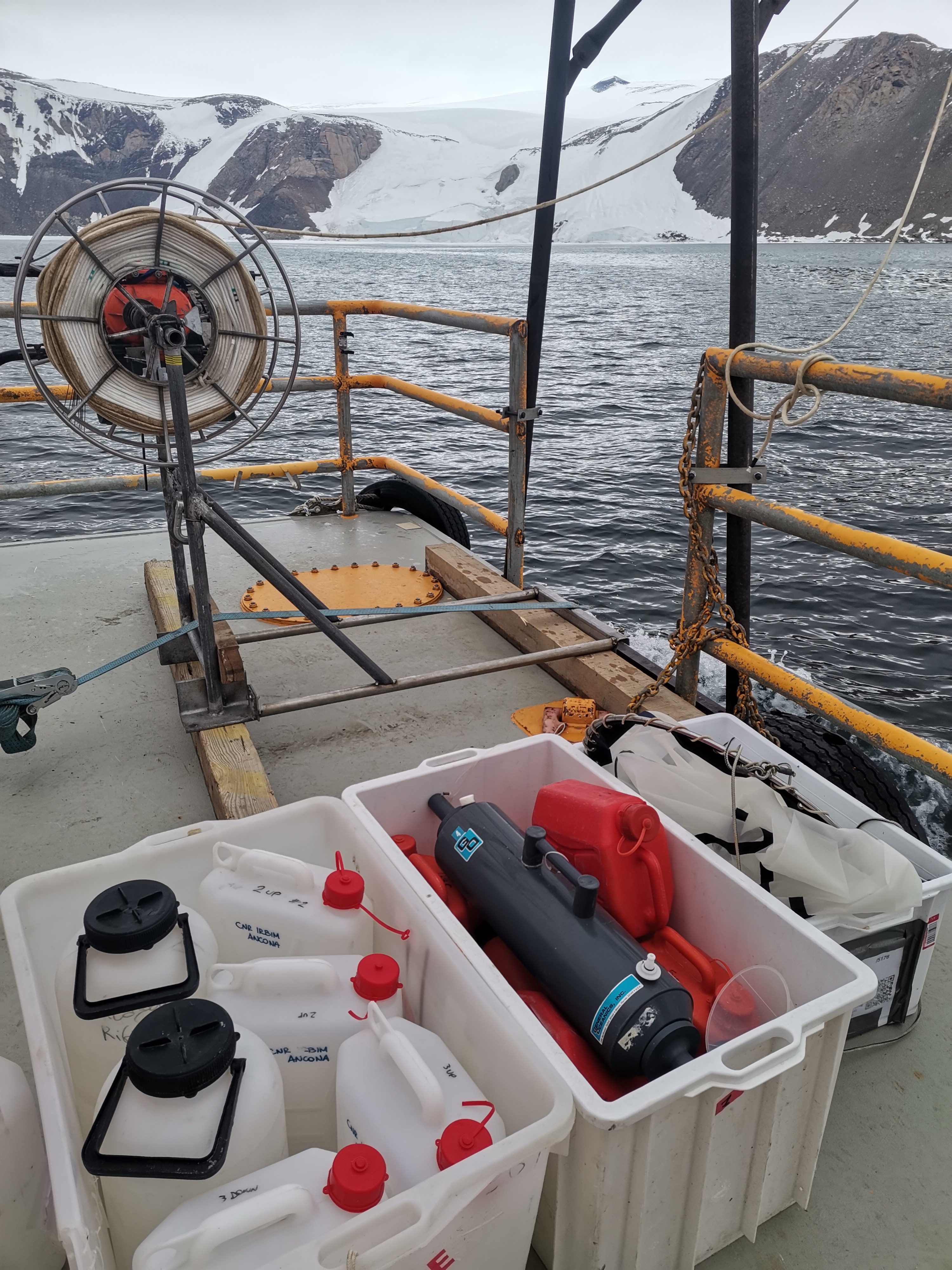
The effects of sea ice melting, and the consequent changes in the trophic conditions in Antarctic ecosystems, have been focused on phytoplankton with cross-food web links from krill to penguins, while the consequences on the planktonic microbial food web (viruses, prokaryotes and unicellular eukaryotes), driving biogeochemical cycles, have been largely ignored. This research investigates how changes related to sea ice melting influence the diversity and functioning of planktonic microbes in the Ross Sea coastal ecosystem of Terranova Bay. The objectives are: i) to investigate the temporal changes of planktonic microbial biodiversity, ii) to investigate the biodiversity/ecosystem functioning relationships iii) to assess the role of viruses on biodiversity and biogeochemical cycles, iv) to identify the drivers that shape microbial biodiversity and functions, and v) to shed light on the interactions within the planktonic food web, and their response to the ice melting. META-ICE-ROSS integrates ad hoc sampling with sophisticated methodologies of high-throughput sequencing of microbial DNA (metagenomics), never documented in previous Italian expeditions at Terranova Bay. The sampling includes the collection of seawater beneath the pack ice at increasing distance from the MZ Station and characterised by different thermohaline conditions, on a weekly basis from early November to mid January. The groundbreaking nature of META-ICE-ROSS will allow to provide unprecedented evidences on the role of microbial interactions in the functioning of the Ross Sea coastal ecosystem, to improve knowledge on biological changes due to global climate changes and, nonetheless, to provide a baseline assessment of the functioning of the microbial food webs and carbon sequestration in the pelagic environment in the Ross Sea region, within the context of the Ross Sea Region Marine Protected Area (RSRMPA) and its monitoring and research plan.
-
ISMAR_AN95 (?) ORA di BAIA TERRA NOVA ctd dicembre 1994 - CTD casts in the Ross Sea Station AN94043 - AN94045 - AN94046 - AN94047 - AN94048 - AN94049 - AN94050 - AN94051 - AN94052 - AN94053 - AN94054 - AN94055 - AN94056 - AN94057 - AN94058 - AN94059 - AN94060 - AN94061 - AN94062 - AN94063 - AN94064 - AN94065 - AN94066 - AN94067 - AN94068 - AN94069 - AN94070 - AN94071 - AN94072 - AN94073 - AN94074 - AN94075 - AN94076
-

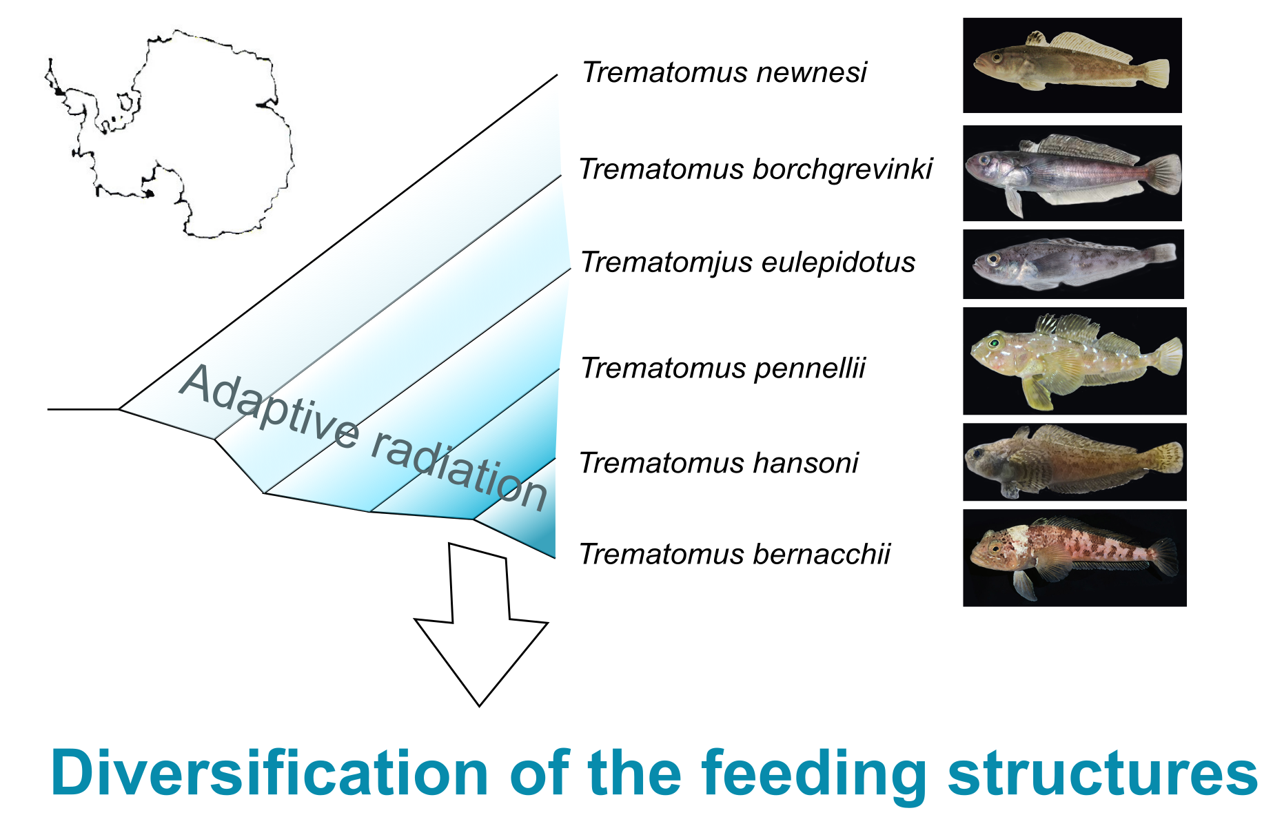
The EMPHASIS project focuses on the ecomorphology of the feeding apparatus of Notothenioidea, a suborder of teleost fishes endemic to the Southern Ocean that have colonized available ecological niches and habitats during their adaptive radiation. Ecomorphology is the science that investigates the reciprocal relationship between the environment and the forms of organisms, allowing insights into their evolutionary history, biodiversity, and relationships between form and function. The research activity involves a comparative analysis of the feeding apparatus in species representative of various phyletic lineages, and the study of the relationships between morphology, function and specific performance during feeding. Based on the results of the analysis, three-dimensional digitally supported models of the structures involved in feeding activity was developed.
-
Antarctic ecosystems have a high number of species, that are closely linked to the presence of sea ice and seasonal cycles. This biodiversity is subject to anthropogenic and natural influences. Zooplankton communities can provide a static snapshot of the health of the ecosystem. Zooplankton samples were collected with a 200 μm mesh net at 3 different sampling points at 80 m depth.
-

The efficacy and reliability of low-impact technologies were tested to document the occurrence and distribution of Antarctic toothfish in sea-ice covered coastal areas at Terra Nova Bay (Ross Sea). Ancillary information, including main water column parameters (temperature, salinity, density, dissolved oxygen, chlorophyll, and turbidity), was collected at each sampling station.
-
The current vision of global climatic changes stresses on the interlinked action of many factors, often more evident at regional scales. Polar regions are among the areas most sensitive to perturbations of the climate: through connections involving ocean, atmosphere, biosphere, lithosphere and cryosphere, they respond to, amplify, and drive changes elsewhere in the Earth system, so that understanding their role is essential. Peculiar characteristics of Polar Regions contribute to modify the energy and radiation budget, and the characteristics of the polar atmospheric boundary layer (ABL), increasing relevance at regional level of coupling processes between components of the climate system, especially in the coastal region. In particular, the long polar night, the sea-ice and snow coverage, favouring the persistency of stable atmospheric conditions, and the local and mesoscale circulation interactions, all affect the status and variability at different time scales of components of the regional climate system. Predicting future conditions of the polar regions is the goal of the Polar Prediction Project and of one of its key elements, the Year of Polar Prediction (YOPP, http://www.polarprediction.net/yopp.html), scheduled to take place from mid-2017 to mid-2019). This requires the scientific knowledge of their present status as well as a process-based understanding of the mechanisms of change. The parameterization of physical processes in regional and global hydrodynamical numerical models of the atmosphere is not yet enough accurate for a correct representation of all components of the climatic system and of their connections, the knowledge of which is needed to determine the role of polar regions in the global climate. As an example, more extended and integrated dataset are required to improve the parameterization of the ABL, for complex orography areas such as the polar coastal regions. The general scope of this project is to improve the understanding of the surface-atmosphere mass and energy exchanges at an Antarctic coastal site in the Ross Sea through continuous and accurate measurements of the atmospheric parameters, and development and verification of multiscale modelling, and through these activities, to address some of the relevant questions included in the roadmap for Antarctic and Southern Ocean science for the next two decades and beyond. Measurements will be carried out year-round at the new Korean Jang Bogo Antarctic Research Station (JBS), located at the coast of Terra Nova Bay, in the vicinity of the Italian Mario Zucchelli Station. Measurement and analysis of radiation components, atmospheric constituents and energy fluxes, meteorological and micrometeorological parameters, will be implemented jointly by Korea Polar Research Institute (KOPRI), CNR and UNIFI, in a way similar to the collaboration already active in the Arctic. Such implementation will be very useful to close a gap in the global climate observation system (GCOS) and contribute to WMO programs providing scientific data and information on meteorological and radiation regimes, vertical structure and chemical composition of the atmosphere.